

Key Takeaways
- Mexico City sits at roughly 7,350 feet above sea level - altitude adjustment is real and worth planning for.
- The city is divided into 16 boroughs and dozens of distinct neighborhoods; your base location matters significantly.
- The Metro system is extensive, affordable, and generally reliable for navigating between major districts.
- Arrival at Benito Juárez International Airport drops you into a dense urban area - plan your ground transfer carefully.
- Air quality varies by season; checking daily forecasts before outdoor-heavy days is a practical habit.
Understanding Mexico City's Scale and Elevation
Mexico City - formally Ciudad de México or CDMX - ranks among the largest metropolitan areas in the Western Hemisphere, home to over 21 million people in its greater metro zone. That scale shapes every aspect of a first visit: distances between neighborhoods feel much greater than a map suggests, and traffic can transform a 10-kilometer trip into a 90-minute journey during peak hours.
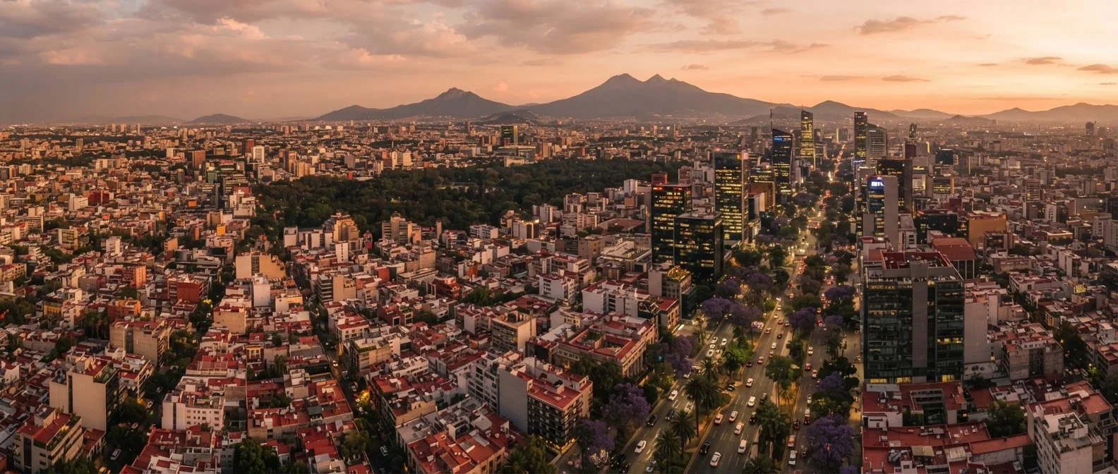
Equally important is elevation. The city sits in the Valley of Mexico at approximately 7,350 feet (2,240 meters) above sea level, making it one of the highest major capitals in the world. Visitors arriving from sea-level cities frequently experience altitude-related symptoms during the first one to three days - fatigue, mild headaches, and shortness of breath during physical activity are common. Staying well-hydrated, avoiding heavy alcohol on arrival day, and pacing yourself during the first 24 to 48 hours can ease the transition. Anyone with heart or respiratory conditions should consult a physician before travel.
On your first night, skip the rooftop bars and evening walks - go to bed early instead. Your body's oxygen-processing adjustment happens fastest during sleep, and a well-rested second day is far more valuable than a memorable first evening.
Altitude acclimatization is primarily a physiological process that improves with rest; pushing through fatigue on arrival day consistently leads to more pronounced symptoms the following morning.
Load a Metro map onto your phone for offline use before you land. Cell service inside Metro stations is inconsistent, and having the line map cached saves real time when navigating transfers.
CDMX's Metro runs deep underground in many sections, and relying on live data in stations leads to missed connections - a common frustration for first-time visitors.
Key Neighborhoods to Know
CDMX is organized into 16 alcaldías (boroughs), each containing multiple colonias (neighborhoods). Most first-time visitors focus on a handful of colonias that are well-connected and visitor-friendly.
- Centro Histórico: The historic core, home to the Zócalo (the main plaza), Templo Mayor ruins, and the Metropolitan Cathedral. It is dense, loud, and historically rich - excellent for sightseeing but noisy for sleeping.
- Roma Norte and Roma Sur: A walkable, café-lined district with early 20th-century architecture, independent restaurants, and a cosmopolitan feel. A practical base for many travelers.
- Condesa: Adjacent to Roma, known for its tree-shaded roundabouts, art deco buildings, and abundant parks. Often chosen for its quieter streets.
- Polanco: An upscale neighborhood near Chapultepec Park, with major museums and international dining. Can feel more insular than Roma or Condesa.
- Coyoacán: A quieter, village-like borough in the south - home to the Frida Kahlo Museum and cobblestone plazas. Worth a day trip even if you base elsewhere.
Choosing a neighborhood near a Metro line or major Metrobús corridor makes navigation considerably easier and less dependent on ride-hailing apps.
Getting Around the City
Mexico City's Metro is one of the most extensive subway systems in the Americas, with 12 lines and over 195 stations. Fares are nominal, making it the most cost-effective way to cover long distances. The system is icon-coded - each station has a distinct symbol alongside its name - which helps travelers who are still building Spanish literacy. Avoid peak commute hours (roughly 7-9 a.m. and 5-8 p.m.) if you have flexibility; trains can become extremely crowded.
The Metrobús (bus rapid transit) complements the Metro along key corridors, particularly Insurgentes Avenue - one of the longest urban avenues in the world. Ecobici, the city's bike-share program, is a practical option for short trips in Roma, Condesa, and Polanco, where dedicated cycling lanes have expanded substantially.
Ride-hailing apps operate throughout the city and are widely used for trips that don't fit neatly onto Metro lines or when traveling at night with luggage. Authorized taxi stands (sitios) outside major hotels and shopping centers are generally considered safer than hailing unmarked taxis from the street.
Avoid Unmarked Street Taxis
Hailing taxis from the street in Mexico City carries a higher risk of overcharging or, in rare cases, more serious incidents. Use ride-hailing apps or pre-paid authorized taxi booths inside airports, hotels, and established sitios. This is one of the most consistently flagged precautions by both travel advisories and frequent visitors.
Arrival and First-Day Realities
Benito Juárez International Airport (AICM) sits within the city - not in a distant suburb - which means you emerge directly into dense urban traffic. Ground transportation options include the Metro (Terminal 1 connects directly to Line 5), authorized airport taxis pre-paid at official booths inside the terminal, and ride-hailing apps once you exit to the street-level pickup zones. Confirming transfer arrangements before landing reduces confusion on arrival.
Terminal 1 handles most international flights; Terminal 2 handles primarily Aeromexico routes. A shuttle bus connects the two terminals and is free of charge. Some flights to or from CDMX now operate through Felipe Ángeles International Airport (AIFA), located roughly 50 kilometers north of the city center - factor in significant additional travel time if your itinerary involves that airport.
On your first day, prioritize acclimatization over activity. A short walk near your accommodation, a light meal, and early rest helps the body adjust to elevation before ambitious sightseeing begins the following morning.
Safety, Air Quality, and Practical Considerations
Mexico City's reputation for danger is often overstated for visitors who take standard urban precautions. Petty theft - particularly phone snatching and pickpocketing on crowded Metro cars - is the most common risk in tourist areas. Keeping phones out of sight in crowded spaces, using a crossbody bag, and being aware of surroundings at night are reasonable habits in any large city.
Air quality is a genuine consideration. The city sits in a basin surrounded by mountains, which can trap pollutants. Air quality indexes fluctuate seasonally, with dry winter months (November through February) and certain spring days registering poor readings. Travelers with asthma or respiratory sensitivities should monitor local air quality forecasts through Mexico's AIRE CDMX monitoring system or equivalent apps.
Tap water in Mexico City is not considered safe to drink without treatment. Bottled water and filtered water (available at most accommodations) are the standard approach. Altitude also means alcohol affects the body more quickly than at sea level - a relevant detail for first-timers underestimating a second mezcal.
Entry requirements, visa policies, and any health documentation requirements change periodically. Verify current conditions with the official Mexican government consular resources and your own government's travel advisory pages before finalizing travel plans.
This article provides general travel information for educational purposes. Entry requirements, safety conditions, and transportation details can change - always verify current information with official government sources and travel advisories before your trip.